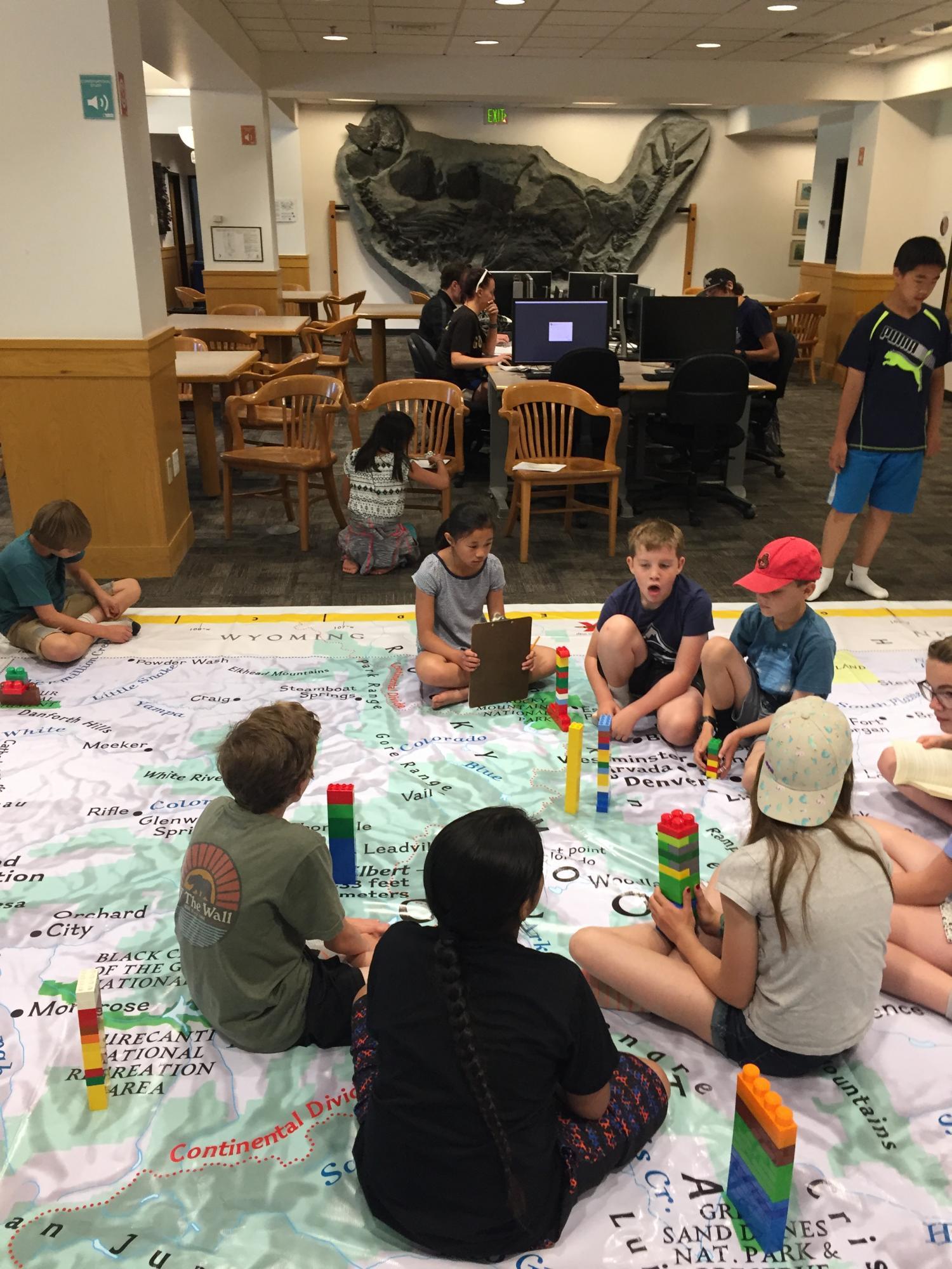
Giant Map of Colorado Joins the Map Collection

It’s a plastic tarp! It’s a Twister mat! No, it’s National Geographic’s Giant Map of Colorado and it’s now part of the collections in the Jerry Crail Johnson Earth Sciences & Map Library.
The Libraries at the University of Colorado Boulder have purchased this 14’ x 21’ map to use for K-12 instruction, as well as for use with university students, especially as a fun diversion during finals. The map’s maiden voyage happened during the recent Map Masters camp, part of the Science Discovery Program here on campus.
National Geographic provides lessons and activities for use with the map, or teachers and librarians can create their own curriculum.
The Map Masters learned about elevations in our state and used LEGO bricks to represent both high and low points in Colorado, while also using atlases and place name books to learn interesting facts about the state. Each group of campers was assigned several peaks and cities or rivers to explore. The mountainous areas of Colorado were easy to see once the stacks of LEGO bricks were assembled and placed on the map.
Map librarians can come to your K-12 school with this map, or your classes can travel to the library to use it. Please email maplib@colorado.edu for more information about the map, lesson plans with the map, or to schedule a visit!

